TFR
ALERT!
FAA TO ESTABLISH TFR OVER
PORTSMOUTH, NEW HAMPSHIRE, ON TUESDAY
A notam has been issued that
will restrict flight in the area during
President Obama's planned
visit.
==> ATTENTION PILOTS <==
NOTE; At this posting AOPA did not have a graphic...
Butt, this is what is looked like the last time
President Bush had a TFR at Pease.
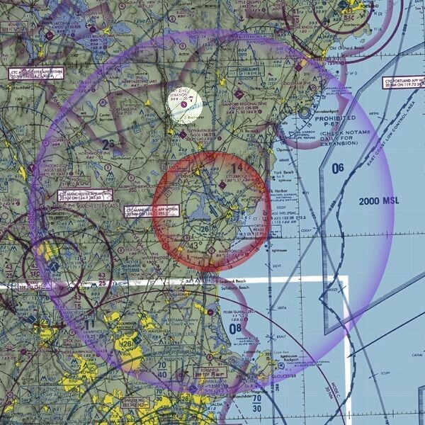
picture is
unofficial postulated rendering
==> 30
nm radius TFR <==
Location:
PSM VOR's
148-degree radial at 2.5 nautical miles
Surface to
17,999-ft-MSL
Times:
11:55 a.m.
until 4:10 p.m. local Tuesday, August 11
==> 10 nm radius
no-fly zone <==
Location:
PSM VOR's
148-degree radial at 2.5 nautical miles
Surface to
17,999-ft-MSL
==> IMPACTED
AIRPORTS <==
Portsmouth
International At Pease PSM
Littlebrook
Air Park 3B4
Hampton Airfield
7B3
Skyhaven DAW
Plum Island
2B2
Sanford Regional
SFM
Lawrence Municipal
LWM
Biddeford
Municipal B19
Beverly Municipal
BVY
Manchester
MHT
_____________?