.
.. RADAR
draggable map
.
.WMUR RADAR

.
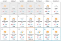
Short Range Forecast

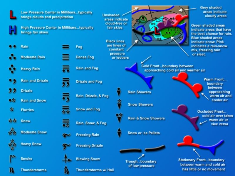
Legends for Prog Charts:

|
|
. FORECAST
LIVE
LINK
TEMPERATURE
LIVE
LINK
.

Aviation Digital
Data Service (ADDS) below.
This is an "interactive"
website for METAR's, TAF's, Winds Aloft and more.
You can click on the
radio buttons (round circle), to activate and show items on the map.
You can also use the
left mouse button to draw a rectangle to zoom to.
[click
here to go to the their website]
|
 |
NOTE: the new update
requires a Java download.

|


|
FAST BRIEF
1LOGIN
TO

2OPEN
FAA NOTAMS

3
CHECK
TFR MAP

4GO
FLYING! |
|


Airport Facility Directory

.
7 DAY PROGS

VFRMAP.COM


SEARCH EVENT
.
The
SFRA area went into effect Feb. 17, 2009.
Make
sure you are prepared by completing the FAAs online ADIZ training course,
Navigating
the New DC ADIZ. Anyone planning to fly within 60 nm of the Washington,
D.C., (DCA) VOR/DME after that date must complete the course before flying
in the area.
CLICK
HERE FOR
AOPA
ARTICLE

AOPA believes that the SFRA
(formerly the ADIZ), as presently configured, is an unnecessary burden
on law-abiding general aviation pilots
UPDATED 8-14-16
|
.

.

.

.

old NSA


|